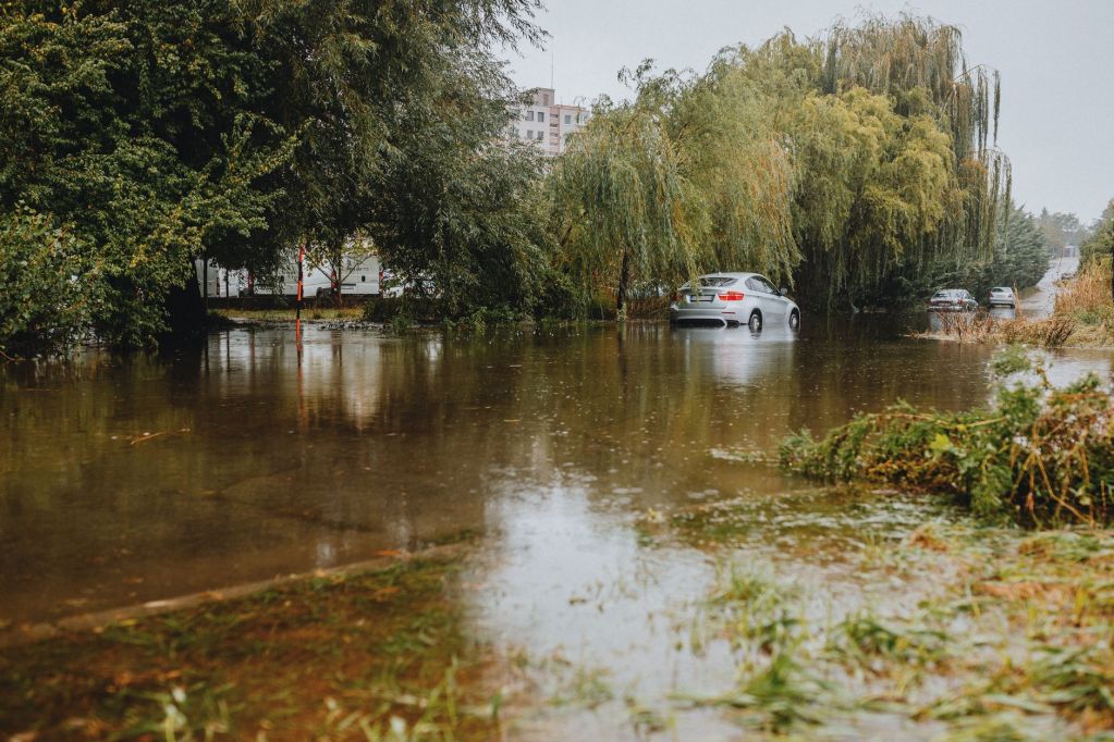
Slow-moving thunderstorms dumped as much as 8 to 10 inches of rain on parts of Broward County, Florida, on Tuesday night, flooding streets, parking lots and a stretch of Interstate 95 and stranding drivers across the Fort Lauderdale area. With a flood watch in effect through Thursday evening, forecasters say more heavy rain is possible on Wednesday along Florida’s east coast.
What happened
The National Weather Service estimated that 8 to 10 inches of rain fell in about three hours across parts of Broward County, NBC6 South Florida reported, with isolated spots possibly reaching closer to 10 inches. Rain fell at rates of 3 to 5 inches per hour at times, according to CBS News Miami, and two flash flood warnings were upgraded to a “considerable” damage threat, a step above a standard warning.
The hardest-hit communities included Hollywood, Fort Lauderdale, Sunrise and Lauderhill, CBS News Miami said. Several flash flood warnings stayed in effect into early Wednesday. The storms also brought hail: CBS reported quarter-size hail in Hollywood on Tuesday evening, while NBC6 reported hail about one inch across.
On the roads, CBS News Miami crews found standing water at Northwest 84th Terrace and Commercial Boulevard in Tamarac, which recorded more than 3 inches of rain on Tuesday alone. In Margate, passing drivers helped push a stalled car out of floodwater off Atlantic Boulevard. Around 8:40 p.m., northbound I-95 was flooded about a mile before the Miami Gardens Drive exit, with poor visibility. At a shopping plaza in northeast Miami-Dade, gym customers came out to a submerged parking lot; some pushed their cars to higher ground, some waded through shin-deep water, and others left their vehicles overnight. Local10 News also reported flash flooding affecting drivers in Miami Gardens and Aventura.
No official rescues or injuries were reported in the coverage reviewed by Upstormed News.
Why it matters
Forecasters said the ground across the region was already saturated, which makes street and urban flooding develop faster than usual. CBS News Miami said a low-pressure system in the Gulf, combined with bands of slow-moving thunderstorms, is driving the rain, while NBC6 pointed to a front stalled to the north drawing in deep moisture from the west and south. Widespread major flooding is not expected, but storms that “train” over the same neighborhoods can quickly overwhelm drainage.
The flood watch covers Miami-Dade, Broward and parts of Palm Beach counties through Thursday evening. On Wednesday, the Weather Prediction Center placed the coast from St. Lucie to Brevard counties under a moderate risk, level 3 of 4, for excessive rainfall, with more than 5 inches possible there, according to CBS News Miami.
Other hazards this week
- A high rip current risk for Miami-Dade and Broward beaches through Thursday evening, with surf of 7 to 10 feet (CBS News Miami).
- Small craft advisories as Atlantic seas build to 10 to 12 feet, plus a high surf advisory for Broward (CBS News Miami, NBC6).
- Possible localized flooding in the Florida Keys from separate storms (CBS News Miami).
- Gusty winds, with Wednesday highs near 81 degrees and widespread showers (NBC6).
What to watch next
Forecasters expect rain to continue through Wednesday before a cold front pulls the Gulf low away late this week or early this weekend, with drier air arriving by early next week. NBC6 noted that forecast models differ somewhat, but the trend points to drier weather later in the week. Upstormed News will follow the storms and any cleanup as the flood watch continues.
The soggy week in Florida comes as much of the country deals with active weather, from the atmospheric river soaking California to the first freeze across parts of the South, just ahead of a busy Thanksgiving travel period.
Why it matters for families
Flooded streets are one of the most common weather dangers for families on the move. Officials continue to urge drivers never to drive through flooded streets or parking lots. A few simple steps can help:
- Turn around if you see water covering a road; it is hard to judge how deep it is.
- Allow extra time for school drop-offs and commutes on Wednesday and Thursday.
- Keep children away from flooded ditches, canals and storm drains.
- Skip the beach this week, or stay out of the water, because of dangerous rip currents.
- If water starts entering your home or car, move to higher ground.
Read more: Flights Near Normal After 16,000 Cancellations; FAA Tests Network for More Risks
Did the storms flood your street or commute? Tell us how your neighborhood is holding up in the comments.
Sources: CBS News Miami, “NEXT Weather Alert issued for South Florida, with dangerous flash flooding across southern Broward” (November 17, 2026); CBS News Miami, “Drivers stranded as torrential rain floods shopping plaza lots, I-95 in Broward, Miami-Dade” (November 17, 2026); NBC6 South Florida, “RADAR: Heavy rain prompts several flood warnings, estimated 8-10″ fall in Broward County” (November 18, 2026); Local10 News, “Flash flooding impacts drivers in several parts of Miami-Dade, Broward” (November 17, 2026).




Leave a Reply